

Week 2: Out of the Shire and into the Frying Pan
- Apr 20, 2015
- 26 min read
Summary: Republic, WA to Whitefish, MT
4/12 – 4/19
433 miles

To view route in google maps: click here
This week I finally started to get into a groove. Soreness, in the legs, knees, and back, although ever present, dulled to a minor annoyance and I no longer fear that I might be injuring my knees. I had several firsts this week including first week without a fall, first flat tire, first bear sighting, first hiking trip, first illegal camping, first car ride and hotel stay, first bear sighting, and unfortunately, my first great disappointment.
I went out from Republic, over the tallest pass open year round in Washington: Sherman Pass, and landed my butt in the Colville Valley, filled with gorgeous vistas, lumbermills, and farms. I found myself sleeping at a veritable zoo (really a farm) with a wonderful family. This was to be my first Couchsurfing experience and a great one at that. I would then travel over Flowery Pass and the ski resort 49° North to arrive in Usk, WA where, by sheer serendipity, I ran into an acquaintance I had met the week prior who invited me sleep at his place on the Pend Oreille River. I left early the next morning and was drenched by sleet and snow as I made a path to Sandpoint, Idaho. That evening I would hike up and downs a Mickinnick Trail and spend my first night in a hotel. I then went ever east and up into the gorgeous Cabinet Mountains of Montana along Highway 56, AKA Bull River Road, perhaps the most beautiful road I have been lucky enough to travel along where I slept behind a tree line and fence which was covered in NO TRESSPASSING signs. I figured it was more of a suggestion. I continued onward and, due to some bike issues, had to cut the day short and stay in Libby, MT. The following day was a long, lonely ride with few cars and much sun up along the Koocanusa Reservoir finishing with me camping at the Rexford campsite. One more short mileage but heavy wind day landed me in my first major milestone destination: Whitefish, Montana. Here I would spend time playing in Glacier National Park, resting, and researching the next leg of my destination. I would then join my friend Jordan Erlenbach as we deviated from the Northern Tier Route and hopped on the Great Divide, a mountain bike route that would take us through Yellowstone and into Denver.
Day 7: Republic, WA Rest Day
4/11
As I was writing my last blog on this day I figured I should start off with it. I woke up at sweat creek with frost covering my tent and my breath clearly visible. Not having anything in the way of breakfast was a staunch motivator and I quickly packed up and was out of camp by 8AM. A short five mile ride, all down hill, brought me into Republic, WA, an old mining town converted into a tourist destination full of Native American history and Americana. I went straight to the visitor center, a tiny, 2-room building. There I was greeted by a portly young guy sporting an anime t-shirt and 4 or 5 days of stubble. After he gave me his “Republic, WA Visitor Center” spiel (for which he was well versed) we talked about shows we liked and games we played, a nerd-fest if ever there was one. After a time he offered to take my bags for me for the day as I explored the town. Apparently there was a fossil site nearby as well as some pretty nice trails and parks. Mostly I just wanted food and a computer. Mr. Visitor Center also gave me the phone number of the local bike shop guy who ran his business out of his house.
Jeremy, the person who ran said bike shop, called it The Sprocket Monkey. He named his business after an old Mike Myers SNL skit which is still on my To-Do list to watch. His house was conveniently located 2 minutes from the Visitor Center. As he worked on my clip-less pedals, which had been giving me some problems, he told me how his day job was as a Canadian border patrol agent and how he worked with a K-9 unit. His brief stories about drug trafficking and dog training captivated me and I cared more about hearing them then having my bike fixed. After he scrounged up the spare parts I needed he sent me on my way with some advice concerning the road ahead of me and some lunch location ideas. Later, as I hammered away at the keyboard on last weeks blog post, he would send me a text inviting me to use his fifth wheel camper trailer to stay in for the night, which was quite convenient being that it was supposed to drop to 28 degrees that night. What’s more, snow was forecasted on Sherman Pass, Washington’s highest open-year-round pass. Jeremy was more than helpful this day. One of the many souls on the road who could renew one’s faith in humanity and I wish him the best.

A fleet of metal horses ran atop old trucks which marked the entry into Rebublic.

Some pretty looking stoves behind the fleet of metal horses.

Historical murals such as this one were common throughout Republic.

The Sproket Monkey put me up in his 5th wheel. Couldn't have asked for more.
Day 8: Republic, WA to Colville, WA 51 miles
4/12
I did indeed wake to brisk morning air but the mostly clear skies promised a good climb. First I packed my gear up, which still took me quite some time even without a tent to collapse, about an hour or so. I made my way about three miles to kick-start my appetite and then ate a giant breakfast (all my meals are giant) just past the Republic Fairgrounds. Then, clicking into my pedals, I looked up the pass in front of me, took a deep breath, and started my way up. I had been thinking snow, I had been thinking a huge, rigorous climb up the “tallest” pass in Washington. Although it was the highest in elevation it wasn’t that big of a climb. I hit the top before I even had to take a break. I must have been in the zone or something but the pass was nothing compared to the daunting feeling that Washington Pass left me with. The view from on top was fairly decent and I could just make out the Cascades in the distance.

I just liked the look of this house with its tree out front (can anyone tell me what type of tree?)

Always time enough to be goofy, especially when halfway up Sherman Pass.

The more my elevation rose, the lower the temperature dropped

Looking eastward from Sherman Pass, the highest (year round open) pass in Washington.

Coming off the east side of Sherman pass.
It was what I saw after Sherman Pass that made my day. I dropped into a small town of Kettle Falls where I passed over the Columbia River, made a small rise over a hill, and then dropped down into the Colville Valley. If ever there was a place to rival the Skagit Valley in beauty, it was here. This brief merge of Highways 20 and 395 was parralleled by steep hills on either side, about half a mile on the northern edge, and two miles on the southern. Everywhere in between was lumberyards and farmlands with the city of Colville in the distance. The train tracks ran just alongside the road and complemented the scenery.

Panorama of the Colville Valley.
As I arrived in Colville I stopped off at the Comfort Inn to sneak some time in on their computer in order to post my blog writing from the previous week. I also needed to touch base with my CouchSurfing host, Angie, who had said I could stay at her place in Colville. At about 5 o’clock I finished my computer use and looked up Angie’s address. It was about 5 miles out of town… up hill… in the wrong direction. I seriously considered continuing on for a few hours and finding a place to camp instead of having to backtrack the next day. However, many hosts make a special meal when they have guests or plan around it in someway and I would feel quite rude, to say the least, to cancel on such short notice. So I dug my heals in to my pedals and motivated the rest of the way to her house, which was north of town. I am so glad that I did.
Angie Barton and her family (her husband Dennis, daughters Ellie and Clarissa (twins), Rachel, and youngest son Luke) lived in a veritable zoo! Really it was a farm, but they had every farm animal I can think of. I conveniently rolled in during evening chores and was given the tour, which was really me guiltily following them taking pictures and watching them work. I saw Ellie (or maybe Clarissa her twin) milk the cows, and Clarissa (maybe Ellie) feed five or six baby goats the harvested milk. Rachel, the middle child, was my tour guide for the evening and showed me the rest of the animals including emus, chickens, horses, dogs, pigs, more goats, peacocks and more. An emu, if u didn’t know, makes the strangest noise I have ever heard an animal make. This particular emu made the sound I would equate to an Indian war drum. Rachel is an up and coming photographer, a topic we discussed throughout my time there, and I was very impressed with her work. That night, before sleeping on a very comfortable hide-a-bed, we would eat pork chops, which I gathered were from a pig they had quite recently slaughtered, and Angie and I discussed topics ranging from GMO crops to the ethics of vaccinations. She was more than welcoming, having honed her hosting skills with the many, many Couchsurfers, the exact number I have since forgotten. The meal was stupendous, and the night's sleep matched it.

One of the twins feeding the goats.

The family dog (one of them).

Cows at sunset.

One of the twins milking the cow.

AHHHH... Pretty colors.

The sound this emu makes, as an onomonopia, can only be described as THUMP, THUMP.
Day 9: Colville, WA to Usk, WA 58 miles
4/13
I woke the next day early in order to capture a time lapse of the sunrise which came over a nearby hill and shines on their farms fields. We ate a filling breakfast of bacon and pancakes, and despite their request that I stay another day (I seriously wanted to stay and in hindsight wished I would have) I made to depart. Before I left however, we took a group shot in their backyard. Unfortunately, Dennis couldn’t make it for he was already off to work in town. After several traditional shots we became more ambitious and decided we needed a shot of us jumping. It took us an embarrassingly large number of attempts before we had a satisfactory photo.

Even out of focus this family looks great!

There was a picture with us all in the air, but for some reasonth, is was my favorite.
I would take the Barton’s advice and deviate from the Northern Tier Route that day away from the more northerly Tiger Pass to go down to Chewela and Flowery Pass. Flowery was supposedly steeper, more scenic, and shorter route. I think its worth noting that I before attempting the pass I stopped at McDonalds for lunch. Come on, it was a weak moment. Once again even the word pass gave me shivers with the memory of Washington Pass still in my mind, but I would reach the top quickly and painlessly once again.


Little bit of macro for your viewing pleasure.

Some wildflowers I stumbled upon.
I dropped into the small town of Usk, WA with the idea of sleeping at Skookum campground but first I needed dinner and was craving a burger. I would eat at the only open gas station/restaurant in town. The two others having recently closed down. I scarfed down three burgers, fries, some Angry Orchard hard cider, and several glasses of water.

My dinner meal in Usk, WA.
Just as I was getting to leave in walked in Mat. I had med Mat previously in Wauconda, a town just before Republic that consisted of a sole diner and whose claim to fame was being sold on EBay. When I met Mat in Wauconda we talked about my bike trip and his job with a lumber company and he had even given me his business card with an offer to stay at his place in Colville. In the end, because I had Angie’s place lined up already, I hadn’t needed to take him up on his offer. The odds of seeing him again, in yet another no-name diner, had to have been astronomical. We shared a beer and then he asked me if I wanted to stay at his cabin on his family’s property, only a few miles down the road, right alongside the Pend Oreille river. It seemed like divine intervention that we met again and I couldn’t very well go against the will of God so I accepted this offer and he showed me the directions to his house on my google maps. As I pulled into their place the sun was just beginning to set. Their property included a waterfront house where Mat’s grandparents lived and a back lot full of little cabin/shacks owned by various members of the extended family. Although I would be staying not in the house but in Mat’s cabin I spent time on the dock in front of the house doing a little photo op. The water was glass and the scenery spectacular. These little coincidences, like my second meeting with Mat, are what makes travelling so great.

Candid picture of Mat!

From the dock at Mat's family home. So serene.

Me trying to look thoughtful.

The cabin wasn't quite as nice as the house, but I was more than grateful nonetheless.
Day 9: Usk, WA to Sandpoint, ID 48 miles
4/14
It would rain that night and I saw yet another opportunity to test out my rain gear the following day. As I left Usk, WA I had the goal of passing into Idaho and reaching Sandpoint. However, the weather would do everything in its power to stop me. What started out as a light drizzle as I left Mat’s cabin turned into a heavy rain, and then the wind picked up, and finally the rain would make a slow transition into sleet and finally snow. What’s more, my entire ride seemed uphill causing me to sweat from inside my many layers. I ended up drenched from the inside out, warm and cold all over, and positively miserable. When I arrived in Newport, WA, my half-way point for the day and lunch stop, I must have looked and smelled like a wet dog. I stopped to eat at the Riverside restaurant which bordered the Pend Oreille River. As I walked in I couldn’t help but feel guilty. I’m sure if my disheveled look didn’t scare away customers my scent surely would. I politely explained my situation and asked to be seated in the back, a request they were than more than happy to grant (I couldn’t blame them). I ate one of those giant meals I always do and was still hungry for more, so I ordered another helping of pancakes.

Hard to tell, but it was snowing and raining pretty hard. Trust me.

Told you!

Getting out of the rain to eat some breakfast at the Riverside restaurant.
During the time of my extended lunch, the clouds parted and sunrays poked through. With renewed motivation I left Newport and departed from the main highways to take backroads which would lead me all the way into Idaho, across the Long Bridge which spans lake Pend Oreille and into Sandpoint, a very nice, mid-sized town full of recreationists. At the end of the Long Bridge (aptly named I might add) there was a tiny strip of beach filled with rocks which patrons had used to write messages in the sand, the majority of which were hearts that contained initials of puppy-lovestruck couples I’m sure.

Wet but excited to be in state #2!!!

Mailbox of the day.

Lunch #2 spot on the Pend Oreille River.

On the Long Bridge crossing into Sandpoint. No longer snowing.


Rocks in the sand at the end of the Long Bridge.
In the center of town, on Oak Street, was where my warm Showers host for the night lived. As I entered into Tanner’s house his girlfriend would invite me in, explaining that Tanner was located in the back brazing his bike. As I opened the door to the workshop/bike shed I saw Tanner, torch in hand, working on a touring bike frame. Mustache clad Tanner did a great job of multi-tasking, continuing to add bronze to the joints of his bike while introducing himself and telling me his story along with hearing my own. I gathered then, and through the next few hours, that he was a jack-of-all-trades, being a bicyclist, outdoorsman, and rafting guide manager. We talked much about his guiding exploits and he gave me some biking tips.

Tanner at work.
With much of the day still ahead of me and it becoming sunnier and sunnier I decided to hit the town with pannierless bike. My first stop was the local ranger station. I had this idea in mind that I wanted to do a hike in every state I passed through. It is worth noting that on my way to the station I saw a sight that latterly stopped me in my tracks with my jaw open. It was a drive-through convenient store. What a practical yet silly idea. I couldn’t help but think my hometown of Burlington could use one of those. To the recommendation of Tanner and the local ranger I decided on Mickinnick trail, a 3.5 mile one way trail that was north of town and overlooked it. My plan for the night was to get a ride from Tanner to the trailhead, hike up to the top, camp there, than catch the sunrise before hiking bike down.
The night went just as planned. I packed up an overnight bag, with just the essentials for a night on the mountainside. Tanner and I crammed into his baby blue VW bug and dropped me off at the trailhead, a mere 5 minutes away via car. I then started up the steep climb but it wasn’t 5 minutes before I realized I had left my water bottles and tripod on the counter at Tanner’s house. I came back to the trail head where Tanner met me with my forgotten gear. Feeling slightly abashed at making him run my errands, I thanked him cordially and sped back up the trail. It really was a great trail. I started right at about 7:30 PM and passed the last few hikers from that day on their way down, pausing briefy to explain why I was starting so late. I quickly ran into snow about half-way up the climb. Despite having done 50 miles on a bike that day in miserable conditions, I was using new muscles and feeling quite refreshed, enough that I thouroughly enjoyed the hike. I was forced to don my headlamp about 30 minutes before reaching the top where I was rewarded with gorgeous views of a Sandpoint dotted with lights. With the Cabinet Mountains right in the background I and an sunrise behind them, I was more than excited for an amazing time-lapse opportunity. I set up my tent, sleeping pad, and camera, as well as ate a little snack. I wanted everything ready for the morning. But as I turned to crawl into my tent in the freezing weather I looked for my down sleeping bag which would make the night’s cold bearable. It was no where to be found. I had left it my other pannier. I was crushed. I hated myself. It was just the kind of absent minded mistake I was prone to make. To my credit, I entered into my tent, pulled my backpack/drybag up around my legs and tucked my head into my fleece. I only had to wait out the 7 hours or so until sunrise. To my credit, I lasted a full hour before fully admitting defeat, packing up my gear, storming down the hillside, hailing a taxi, and spending the remainder of the night in a motel. It started out a crappy day and it ended a crappy day. On the upside, I did get to take a long, refreshing bath at the hotel, falling asleep briefly before crashing in bed.

Drive through convenience store... say whaaaat?!

Halfway up Mickinnick Trail.

At the summit of Mickinnick, before I realized Il ost my sleeping bag. Would have been a great sunrise time lapse... someday.
Day 10: Sandpoint, ID to Bull River Road (Mile 8), MT 53 miles
4/15
I woke up in the hotel, took a shower, and made the short 20 minute walk back to Tanners house. I walked through the door with my tail between my legs and explained to Tanner my sob story from the night before. He could have given me a hard time about it, but he didn’t. Instead he told me he would join me for a stretch of my ride today, getting a workout in while making sure I wouldn’t get lost (something I’m sure he thought would be assured given my track record the last 12 hours). Together we road, at fairly brisk pace, around the north end of Lake Pend Oreille, past the Pack River delta which fed into the lake, but once we hit the East end, some 15 miles later, and after a brief photo op, we shook hands and Tanner wished me the best of luck. Despite the time we took saying goodbye and taking pictures, I only made it about 10 more miles down the road before coming to Trestle Creek, a lakeside picnic spot. I was determined to do a time-lapse in every state, and this was my last opportunity, and it had a fairly decent view, so I set up the camera and ate an early lunch.


After that I would only go about five more miles before my next stop. I came upon a stalled car on the side of the road with one guy inside, driving, and another outside with his hands on the rear bumper, unsuccessfully trying to push start the car. I hopped off the bike, added my hands to theirs, and together with an enormous amount of manly strength and an excess of grunting together we… unsuccessfully tried to push-start the car. Oh well, it was the thought that counts. I left them to figure it out and continued on. I would eventually leave the lakeside, turning more easterly, and would come to the town of Heron, unknowingly crossing into Montana, where I would head north again turning onto Highway 56 AKA Bull River Road.
Bull River snakes its way through the Cabinet Mountains, a range and a road that would surpass Highway 20 in my mind as the most scenic drive. There were vast mountains on either side and with a the sun clipping those peaks it was picturesque. About 8 miles up the road my legs would start to get tired and I looked for a place to camp for the night. I would come to a bridge crossing with great views in either direction and flat ground to camp. However, I had concerns camping so close to the highway in such a visible place (The horror movie The Hills Have Eyes came to mind) so I backtracked a bit and found the perfect spot behind a tree line… which was behind a gate and fence, which had big red and white letters on it that read NO TRESSPASSING. It seemed remote enough so I disregarded the warning with only a modest amount of apprehension and set up camp.

Some nice, oldy pick-ups I saw in a quarry before getting to Heron.

The view on Bull River Road.

Essentially this is right where I camped.

First time scamping (Scam-camping). No tresspassing sign and fence were right beihind me.
Day 11: Bull River Road, MT to Libby, MT 43 miles
4/16
That night had been the first without a rainfly and I fell asleep under stars and tress tops that made me feel like I was truly wilderness camping. Although I got up early, around 5:30, I took my time packing up, eating a breakfast of ramen noodles, cereal, and tortillas with peanut butter. I would then snap a few early morning sunrise pics and head on my way. I stopped for breakfast/lunch at the only restaurant I passed on the road, a place named the Half-way house. After eating a large and filling burger and making small talk with the owner/cook/bartender who had just moved up from LA, I moved on and quickly finished the scenic Bull River Road.

Good mooooring USA!
The end of Bull River connected me with Hwy 2 and would send me into Libby, MT. I was considering stopping for the night in Libby being that I already had a Warmshowers lined up but it would make for a short day so I kept my options open if I wanted to continue on. However, before getting to Libby I had to make a pit stop, for Kootenai Falls was on the way. Lying on the Kootenai River, a short hike from the highway, I stopped for lunch. The falls were really special, and the steady roar they made was soothing as I ate lunch and sunbathed on outlying rocks. I would read that the Kootenai Falls is the largest undammed falls in the state. It offers an unforgettable and breathtaking view as the Kootenai River loses 300 feet in elevation traveling a few hundred yards down river. Nearby is a swinging bridge that is reminded me of scenes from one of my favorite movies from my childhood: Indiana Jones and the Temple of Doom. The bridge spans the river and provides access to the opposite side of the Kootenai River, a prime Montana fishery. To the Kootenai tribe, the falls is a sacred site. They view it as the center of the world, a place where tribal members can commune with the spiritual forces that give direction to the tribe and to individual members. Archaeological evidence shows the Kootenai had Native American sweat lodges and encampments up and down the river valley.

Kootenai Falls.

Captain Morganing it.

Let me take a selfie.

Did someone say swinging bridge!?

"No Doctor Jones, you cheat!"
I begrudgingly left the falls and got back on the highway but soon my bike began making sounds I didn’t much care for. I stopped and reached down to feel my spokes and found many with no tension at all, feeling more like flaccid rubber bands and less like the supporting pillars of my wheels that they should be. So as I arrived in Libby, with wheels spinning in a fashion that was not at all symmetrical, I stopped into the local sports store to ask directions to a bike shop. Apparently, the store owner also performs bike repair. Mr. Bob the store owner (or manager, I wasn’t really sure on that) took my bike in back and began truing my wheels (straightening them by tightening spokes appropriately), a feat that was much harder than it looked… and it looked pretty hard. After about 30 minutes he had it just right. I asked him how much he wanted. He said his bike services were free. I thanked Bob and, considering my bike malfunctions a sign, decided to stop in Libby. I made a steep climb at the end of town to arrive at my Couchsurfers home. Joe and Julie, a retired couple in their 70s, were exactly the kinds of hosts a traveler can hope for. They were welcoming, genuinely interested in my story, and open about theirs. I came to find out that Joe was a retired Civil Engineer, and Julie a school teacher. Together they had over 30 exchange students in as many years. They made me a giant omelet for dinner, taught me a wonderful card game named Quibbler, a kind of Scrabble with cards, and showed me to their guest room where I promptly fell asleep.

Mr. FixIt, AKA Bob, helping me true my wheel.


Joe and Julie, playing their daily game of Quiddler with me.
Day 12: Libby, MT to Rexford, MT 68 miles
4/17
Wild turkeys outside my window would wake me before my alarm would, but not too much. Joe would cook me an all you can eat breakfast of waffles (with many leftover to take on the road). Before leaving I insisted on playing another game of Quiddler, and lost once again. I vowed to return one day and beat them at their own game. I left town heading north but quickly veered east heading towards the Koocanusa Reservoir. Here my route had two potential paths. I could ride on the east side of the lake and stay on the main highway, or I could take the forest roads on the west side of the lake, a much less well maintained but less traveled road. On the forest road there were no service stations and no service, and with little to no traffic I could be isolated the entire 50 miles it runs. However, before coming to the fork in the road where a decision would have to be made, something catches in my tire and I hear the CLINK CLINK CLINK as it spins in my rear wheel. Some kind of metal wire had punctured my tire and air was leaking out at a fast pace. This made me smile instantly! I was waiting for the opportunity to change my first bike tire, an experience any true cyclist has had. I took it one step further: instead of changing my inner tube, I patch the existing one using my patch kit and super glue. I replace the tube on the rim, and the tire on the tube and voilà! It held the air.

Changing a flat is easierth an it looks.

Some riverside wildflowers.
With my spirits high I decided to attempt the forest road. I am a road less travelled kind of guy after all. The road splits at the Koocanusa Damn and I had to make a steep climb to get up to the level of the damn. Passing the damn there was a large sign reading ROAD CLOSED FOR WINTER. It even gave a number of the local rangers to call for questions. I tried the number but had not service. Oh well, there was no snow, it was a bright and warm day, and I figured I could carry my bike over any potential obstacle I might face. I was a little dismayed to find there was no such obstacle, besides a very poorly maintained road with lots of bumps and cracks it was a splendid, if isolated ride. I passed maybe five cars (but several dozen deer) the whole day, some 50 miles. But the views were spectacular, and the sun beat on me all day, the lower temperatures making it refreshing and not overbearing. I listened to my audiobook Outlander, and the exotic Scottish accent of the narrator kept me company. It was a tough ride. Up and down, up and down. Luckily, I had a slight tailwind to push me that extra bit at the crest of the hills.

Dam Damn!
As the sun began to fall, I approached the end of the service road and the Koocanusa bridge, for which the signage boasted was the longest and tallest bridge in Montana. As I stopped on the side of the bridge, one of the few cars I saw that day stopped beside me. The white SUV had a full complement of passengers. The driver, the father of the family, pulled his rig over, turned it off, and began a long and pleasant conversation with me, capped off with a group photo on the side of the bridge and his well wishes.

God is a wonderful artist.


The friendly roadside family, such a nice group, i wish you well.
Only a few more miles, now on the east side of the lake would take me into Rexford Campground. I was long out of water, parched and hungry, and desperate for some deep fried food. As I pulled into the campground, full of trailers, RVs, and tents, I was immediately assaulted by the wonderful smells of BBQ that are typical of campsites. Although they were familiar aromas, in my current state at the time, that place smelled like heaven.
Most of the campers seemed to be congregating at the sports bar which was centrally located. People of all ages, at least a hundred I imagine, were piling out of the bar with grilled food galore. My mouth was watering before I walked in the door. I ended up eating a 16 ounce steak, 6 prawns, a baked potatoe, and side salad. That was a large meal in and of itself but I wasn’t satisfied. I then ordered a half-pound burger and fries and ate it before it quit steaming. I was the only one in the place not wearing plaid or camo, and I happened to still be in my spandex shorts. I stuck out like sore thumb. But I was obliviously content. I think the bartender felt sorry for me because she kept handing me drinks that were “misordered” and had to be drunk. I agreed. At the end of the night I had two shots, an angry orchard, bud light, and two mixed drinks that tasted delicious, all on the house! As I stumbled out of the bar I must have been a funny sight as I tried to set up my tent. It had been a long but surprisingly good day and I fell asleep with all my shoes on and didn’t even bother with a sleeping bag. I would wake later in the night, shivering but my sleeping bag was close at hand and after draping it over me had the best night sleep of my journey so far.
Day 13: Rexford, MT to Whitefish, MT 59 miles
4/18
Because of the long day before I was planning a short day to Whitefish. Whitefish was to be my last stop of the week where I would take several days off preparing for the next leg of my journey. I left camp after eating a meager breakfast of granola and tortillas and left Rexford in my review. The day was filled with views that I had in my mind as typical Montana: rolling green hills and farmland with a backdrop of mountains. The occasional osprey and bald eagle floated overhead. The day was quick and mostly uneventful. I did stop in Eureka, MT for a second breakfast. I had a craving for chicken teriyaki and ate two servings of it. (I’m pretty sure I’m gaining and not losing weight on this trip). Despite the shorter day, I was buffeted by a light but ever present headwind which made going slow and sapped my motivation. Eventually, I would arrive in Whitefish, a resort town of roughly 6,000 which was overshadowed by Big Mountain and the Whitefish Mountain Ski Resort, a resort which had closed only the week prior. My Warmshowers hosts that evening would be Rita and Chuck, yet another couple who welcomed me with open arms, a shower, and a hot meal. I would tent in their back yard, going to bed after dinner so as to get some reading time in, time which was very precious while touring. Before going to bed they would offer to take me into Glacier National Park or, as they affectionately called it, “The Park,” to do some biking. Although my legs were more than tired and the following day was supposed to be a rest day, I couldn’t turn down the opportunity to see the renowned Glacier Park. So I set my alarm, read for an hour or so, and fell asleep.

Cool little beer can plane with my tent in the background.

Glad i brought that telephoto lense now, got to see some ospreys in theirn nest.

Finally saw something that had the word Montana on it!

What are these? Chipmunks?

Classic Montana.
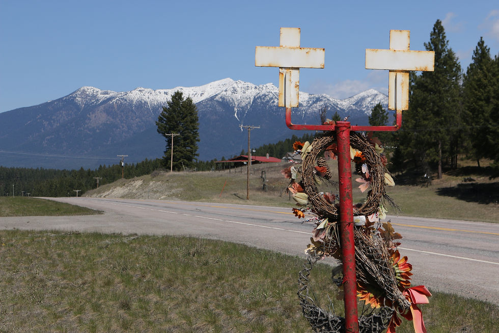
These markers are scattered all along the highways in MT, marking fatalities on the roads.


Would have been a real sweet pic if I was in focus!
Day 14: Whitefish, MT "Rest Day" 53 miles
4/19
We were planning on leaving at 9:30 in the morning so I awoke at 7:00, giving me enough time to go into town and eat breakfast. I went to the Swift Creak Café and ate some an all-American breakfast accompanied by French toast. The café had this amazing blueberry cream to put on the toast and when I complemented to waitress on it she told me the locals refer to it as “blueberry crack” because it is addictingly good. I agreed. I came back just in time to back up and load my bike on the rack on the back of Chuck and Rita’s SUV and hopped in along with another one of their friends. The fifteen minute ride from Whitefish took us into West Glacier where we parked the car, put our bike shoes on, and took off for what would be the most amazing ride.
Immediately after entering the park we came upon the Apgar Visitor Center which overlooked Lake McDonald, a skinny ten-mile long lake with snow covered mountains surrounding. Hopping on the Going-to-the-Sun-Road, a world renowned scenic highway, we followed the east side of the lake, quickly passing the lake and following McDonald Creek as it wound its way between striking mountains. Tgus road was only open to cyclists at the time, opening to cars once summer arrives. Every time I turned my head there was a new, breathtaking view. The scenery, floura and fauna, was astounding. The best of my trip (I know I keep saying that but one thing keeps topping the last). Eventually, the flat road next to the lake began to climb, up and up. Maybe that’s why they call it Going-to-the-Sun. At one point I was passed by a group of guys in the late 20s or early 30s all carrying skis and boots. After my inquiry they would tell me it was one of the guys’ bachelor parties and they were going to bike until they hit snow and then climb to the top before skiing down. I took a break at this hairpin turn called the Loop, about 27 miles into the ride. The Loop was a popular break spot as it was filled with bicyclists of all ages. The bicycling community was a small one as I was learning on my trip, and everyone seemed to know one another. So friendly were they, that as soon as I was introduced to one rider they would introduce me to yet another, shaking hands from one to the other as if it were some version of the childhood game telephone. All were eager to hear about my route and gear. At one point it came out I enjoyed playing basket ball, and one of the locals named Phil regaled me with stories of how he used to know and play with Phil Jackson. Chuck and Rita, with fresh and much more fit legs, had long since passed me. The road would be eventually blocked off and they were determined to ride as far as they can. I continued upward from the Loop but quickly met them coming back down and in the interest of time (and my angry legs) I pulled a Uey and followed them back down. The views on the way back were just as great. At one point, just past the only tunnel on the road, I saw several people stopped and staring upwards with their camera. I looked up to find a bear in the trees munching on the spring leaves. I hastily pulled out my camera and shot some video. First wild bear I had ever seen. Later down the road, we passed an acquaintance of Chuck and Rita’s named Sue who offered to take me rafting the next day. I was giddy just at the thought but apprehensive because of all the things I needed to do as far as preparation for the great divide.


Rita and her friend.

McDonald River

Rocks had a subtle pink shade here. Any geologists out there that can tell me why?

Picture doesn't do it justice. Sheer rock face, enormeous.


The hairpin Loop. Rest stop.

Bear!
After reaching the rig, on the way back to Whtiefish, we stopped at this unique store called All-Things-Huckleberry. It looked like a cuddly teddy-bear ate a gallon of purple huckleberries and threw up all over the walls. Everything was purple and related to huckleberries in some ways. Did you know that the huckleberry was the state berry of Idaho???!! I did now. We all ate some amazing huckleberry ice-cream, I got some jam to go with my tortillas and peanut butter, as well as a postcard to send to my brother, and we left for home. I would then spend my second night at Chuck and Rita’s house, not feeling refreshed necessarily, but happy nonetheless. Tomorrow would be my rest day. Although I dearly wanted to go rafting, I decided to do the responsible thing and rest and take care of my to-dos, which included all my laundry that was in much need of washing. It has been a long yet pleasant week.
Comments