

Week 3: Roads? Where we're going we don't need roads.
- Apr 26, 2015
- 19 min read

View map on google here.
Summary: Whitefish, MT to Helena, MT 230 miles
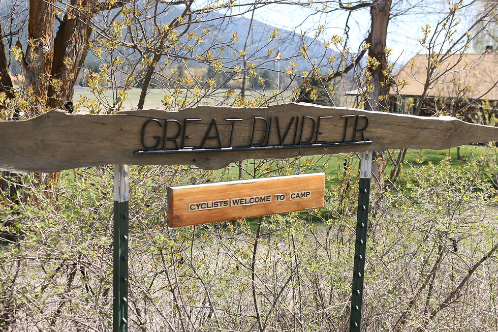
This stretch of my journey would take me South through northern Montana on the Great Divide mountain bike route. I would be joined on this journey by my long time high-school friend Jordan Erlenbach, a Wildlife Ecology major from WSU who currently works for Fish and Wildlife in Wenatchee, WA. He was able to use some of his PTO to join me. We would leave Whitefish and make our way to Bug Creek, utilizing the Adventure Cycling map to guide us, the first time I had used a paper map so far. After Bug Creek we would gain in elevation and quickly hit snow, forcing us to push our bikes making for a long, long day. We would eventually arrive in Condon where we stayed in the backyard of a restaurant called the Hungry Bear. From there we went to Upsata Lake where we had a wonderful campfire, cooked a steak dinner, and enjoyed various forms of wildlife. After Upsata we went through Lincoln, MT and turned up Flesher Pass. We would camp halfway up the pass that night. Yesterday we finished the pass in no time and coasted downhill into Helena where we hopped in some “hot springs” and Jordan had his first Couchsurfing experience. Our mileage per day was significantly less than what I was putting on by myself, but we were on many dirt roads and singletracks (not to mention snow) that made for slow going. We tent camped every night except last night in Helena. Jordan will be getting picked up this evening and going back to work whilst I continue southward.
Day 15: Whitefish, MT Rest Day
Monday, April 20th
I did very little today. Mostly just relaxed my tired body and prepared for the next leg of my journey. I really didn’t know what to expect. I was hopping on the Great Divide, a popular mountain bike trail that traversed the continental divide from Banff, Canada to Mexico. The recommended season for this trail begins in late June. I was a whole two months early. After breakfast at a neat little café in downtown Whitefish, I went to the local bike shop to purchase the maps I would need. Unfortunately, they only had the second and third portions of the map I needed, made by Adventure Cycling. I would have to wait until the following morning when the post arrived to complete my set. Also arriving the following morning would be my longtime friend from high-school, Jordan Erlenbach. Jordan and I had been roommates throughout college at WSU, him a wildlife ecology major and me a mechanical engineer. Throughout the years we have gotten ourselves into considerable mischief and I could think of no better friend to take on this journey through Montana. He planned to arrive the next day via the Whitefish Train Station with his bike packed neatly in a box.

Doing laundry.

Chuck and Rita's home in Whitefish, MT.
After hitting up the bike shop, Glacier Cyclery, for all the resources they could give me I headed for the local library where I would write and post last week’s blog. That would take me the better part of the afternoon. I had quite the appetite worked up by the time I finished and decided to eat dinner at the Buffalo, a popular dinner spot that several locals had recommended to me. I soon found out why it was so popular. Apparently, to work at the Buffalo you have to be a girl in your mid-20’s and drop dead gorgeous. I even noticed the cooks, grease stained and all, were of the same demographic. Needless to say, I took my time with my dinner, even ordering some dessert.
Day 16: Whitefish, MT to Bug Creek (mile 2), MT 43.2 miles
Tuesday, April 21st
After another refreshing night in the yard of Chuck and Rita I packed up a frosty tent in less than an hour. I said goodbye to my gracious hosts after eating some granola cereal and yogurt they provided me. I left for the train station which was less than a half-mile away, planning on meeting Jordan there. He had taken a bus from Wenatchee, WA to Spokane, WA in order to hitch a ride on a train that would carry his bike with him to Whitefish. It was 8:00 in the morning and his train had arrived a half hour earlier. I walked into the station and saw three world travelers, complete with dreadlocks and backpacks. I can only imagine they were arriving home from trips in southeast Asia or Africa or some equally exotic destination. But there was no sign of Jordan. I had a brief moment of panic, thinking to myself, “I wonder if there is another Whitefish, Montana?” But I stepped outside the back door onto the station platform and found Jordan there assembling his bike. After a long bear hug that only best friends are allowed to do we took an inventory of his gear and tied it up on his bike. Jordan was equally as unprepared as I had been, if not less so. He had done no longer ride than 20 miles the week before joining me. Fortunately, where preparation ends, willpower begins, and we were not in short supply of that. After disposing of the cardboard box his bike had been shipped in (cutting it into bite sized pieces and stuffing it in the much too small trash bin) we ran a few errands. Grocery store. Post Office. Bike Shop. When the bike shop opened at 10:00 I was hoping they would have the first part of the map that I needed for my trip which included the route for that day. But as 10:00 rolled around and the shop opened I was dismayed to find the mail had not arrived yet. So Jordan and I toured the art galleries and antique shops that dotted downtown. We actually saw some really stunning oil paintings, and one gallery owner who was a bronze worker gave us a lecture on the finer points of bronzing.

Rita and Chuck, saying their fairwells.

Meeting Jordan outside the train station. Platform 9 and 3/4.


Checking out the art galleries in town.

Shot of downtown Whitefish.

Left our bikes at Glacier Cyclery while exploring the town.
At 11:00 we checked back into the bike shop and found that the mail had arrived but no map. I asked around to see if anyone in town even had a Great Divide map that I could take a picture of but no one seemed to be able to find theirs. It was an incredibly frustrating way to start the day, I couldn’t believe Whitefish, a notable biking town and critical stop on the Great Divide, didn’t have part 1 of the map I needed! To their credit, the owner even rode her bike home to look for her map, which had disappeared, likely given to another unprepared traveler in a similar situation. Luckily, Chuck, my host from the nights prior, had printed me off a Google maps that would lead me to Big Fork, the first leg of the journey. I got on the phone and ordered the map I needed from Adventure Cycling, asking them to deliver it General Delivery to a town a few days away. We would just have to wing it until then.
The rest of the day went much smoother. The map Chuck had printed was fairly easy to follow, despite many turns. The route took us through beautiful country, on highways to rural farmlands, forested areas and gravel roads. We made one wrong turn but it took us across a land bridge that passed through a fishing lake. With the mountains in the backdrop, we took a pretty stellar selfie that made the detour worth it. As our route neared Big Fork we followed a walking trail that passed a flathead dam. Although the prime viewing spot was fenced off and locked, the 8-inch space between the gates seemed like invitation enough for us. After a photo-op of the dam we finished the walking trail and ended up in Big-Fork, a western-style tourist town. After stocking up on water in town it was still early so I looked up the next day’s route on my phone (using a primitive map that Adventure Cycling posts on their website). It would take us to the town of Ferndale. We pressed on but immediately upon leaving Big Fork we were hailed down by a pedestrian. He was an adventure tourism shop owner and wanted to ask us about our bikes and where we were going. When he found out we didn’t have the map yet he offered us his (for a fee) and offered us a place to stay at his campground outside Ferndale (for a fee). Although we accepted the map we declined the campground. We now had a map to follow. We continued on through Ferndale towards Bug Creek Rd, a climb which we would save for our next day. Before camping for the night we wanted to top off our water sacks so we stopped at the first inviting house we saw to ask for water. The front door was open so we just walked up and hollered inside and were greeted by a most welcoming lady who was happy to let us fill up. We chit-chatted a while, mostly about bears in the area and how her two Great Danes kept them at bay. We thanked her, rode about three more miles up a fairly remote forest service road by the name of Bug Creek, and set up camp for the night. Jordan, with a more extensive JetBoil cooking kit, cooked us up some quinoa and lentils for dinner with some leftover for breakfast. With full bellies, and more than a little apprehension about the local bear population, we went to sleep, bear spray close at hand.

This backdrop is classic Montana.

Passing along some fields.

This was actually taken while backtracking because of a wrong turn I took. Mistakes are good.

Same backtrack view.
Came across this house on the trail. Owner offered us water and a place to camp.

So, this is interesting. Most Montana mailboxes need protection of some kind. Many are decorative, this one is merely practical. Those that don't have a cage or barrier of some sort are beaten into with baseball bats by unruly teenagers. I feel like this isn't as big a problem in Washington.

I love seeing these signs down long driveways. Makes it so homely.

Mailbox of the day.

Flathead dam, near Big Fork.

Pretty view.

Finally found our map!

Where we found the map, just outside Big Fork on the road to Ferndale.
Day 17: Bug Creek, MT to Condon (Hungry Bear), MT 48.4 miles
Wednesday, April 22nd
The following morning, I packed up our gear and tent while Jordan made pancakes. More accurate would be to say Jordan tried to make pancakes. Despite his brand new JetBoil pan, the pancakes kept burning and sticking, leaving us with something that was a half-cooked mush and not entirely appetizing. While Jordan was struggling with breakfast, I noticed that there were some brand new deer droppings less than a foot from our tent, right next to where my head had been laying. I hadn’t even noticed during the night. It was… a little unsettling. Jordan turned this cooking endeavor into a matter of pride and continued to experiment with heating temperatures and batter thickness while I occupied myself taking pictures and reading my book. Although his technique improved, the pancakes still didn’t turn out quite like we wanted, so we dumped the remaining batter and finished off the quinoa instead.

Love waking up with the sun.

Jordan's water bag.

Wasting time while he "cooked" pancakes.
After loading our bikes up we continued up Bug Creek and the road/trail became progressively more weathered. At first we saw snow patches off the side of the road, then we had to start dodging them on the road, and finally we had to dismount our bikes through sections to push them. But still our elevation increased. Eventually we were trudging through two feet of snow with 90 pound bikes. It was not fun. After about two hours of misery we finally reached the peak of the hill and began back down. My thumbs were killing me. Having dislocated them repeatedly over the years, the pressure of pushing and pulling the bike was wearing down the tendons in my joints. But the downhill promised an end to the misery. It took much longer than we expected. We kept on banging the backs of our legs on our pedals too, which was more annoying than painful, but occasionally quite painful. Often, in such a state of exhaustion, I found myself hysterically laughing and asking Jordan if he was having fun yet. After 3 seemingly endless hours of pushing our bikes through the snow we made it back to gravel and coasted the rest of the way back down this hill. I would seriously need to reconsider my route planning in the future. There is a reason the Great Divide isn’t meant to be ridden until late June. As we neared the edge of the service road we crossed a bridge and replenished our water from the river, using our water filters. We spotted an interesting bird floading on a log in the river dunking his head in the water over and over. Jordan explained this bird was called a dipper, an apt name. Jordan was full of this kind of information and he quickly became my resident naturalist encyclopedia for the week.
*PG-13 Photo Ahead

First spot of snow.

Jordan's tats he got in New Zealand.

Snow was an average of 8 inches deep but got up to 2 feet!

Bear tracks!

*Jordan and me saying screw you to the mountain. Causes us a lot of sweat and tears.

Coming down of the mountain into a whildlife preserve.

A dipper on its log.
After coming down off the forest road we got back on the main highway heading for Condon and some warm food. Although we still had over 30 miles to go and it was already late afternoon, we found ourselves with a second wind now that we were on paved roads. As we pulled into Condon around 7:00, we asked at the first convenience store how close the nearest restaurant was. They told us it was the Hungry Bear (which sounded incredibly appetizing) but it was still 6 or 7 miles down the road. I know it doesn’t sound that far, but when you’ve had a day like ours it was quite a distance. But we saddled up and made our way back down the highway. We would flag down a passersby and ask them how much further, yet everyone seemed to have a different estimate. Eventually, exactly 7 miles down the road, we arrived at the Hungry Bear. Jordan and I both ordered a burger with fries and a 12” pizza. We ate it all. We asked the cook/owner of the restaurant if he wouldn’t mind allowing us to camp in the grassy area behind the restaurant. He said yes but quite reluctantly. Although a big part of me wanted to be polite and refuse because of his reluctance, we were both so tired and looked forward to the prospect of eating breakfast there again the next morning, so naturally we had our tent erected before his offer was half-way out of his mouth.

Riding into Condon, MT.


Just before the Hungry Bear.
Day 18: Condon, MT to Upsata Lake, MT 42.4 miles
Thursday, April 23rd
Our campsite at the Hungry Bear, although within a primitive fence, was located adjacent to a forest. During the night we heard some very interesting animal noises and at one point a particularly strange snorting noise seemed to be encircling our tent. We did not investigate. After deliberating in the morning we determined it was most likely a deer… "most likely" being the operative phrase. We did indeed eat a large breakfast of omelets and biscuits and gravy. While Jordan was finishing up his meal, I locked myself in the bathroom, plugged the sink with some paper towels, and proceeded to wash my laundry. I would then attach it to my bike in various places to let it air dry. A very thifty way to clean your clothes while on the road.

Dirt roads aren't so bad, when they have a view.

Leaning against a ponderosa.

Compare this pic with the last.
Right out of Condon we again left the highway to resume the Great Divide route as we took another forest service road. The forested area we meandered through was full of skyscraping ponderosa pines and acorns littered the roadway. The sun was out (and there was no snow on the trail) so we were in high spirits. Eventually the trail we followed turned into a single track mountain bike trail that was so steep upwards we were forced to push our bikes for fear of toppling backwards. On the way down the track turned into another gravel road. The jarring bumps on the road kept knocking Jordan’s secondhand panniers off his bike which made a cringing sound as they thwapped against the spokes of his tire. I’m sure there was a way we could more securely attach them, but we didn’t.

Nice view on the trail.

Perspective of my tire.

Forest road general look.
After getting back on the highway we stopped at the Lolo ranger station to do research on the next few days’ route. We didn’t want to hit snow again. We had learned our lesson. The ranger there, a lady by the name of Janet, was quite passionate about her job. Even though she must have worked that post for many years, she was genuinely interested in educating us on the local flora and fauna as well as helping us route our next days trip. She advised us to camp at a place called Upsata Lake, which was only a few hours ride further. Although it deviated from the Great Divide route, I was quickly learning to adapt my own style to this route and had no problem blazing our own trail. On our way to Upsata Lake we passed through the town of Seeley Lake where I would pick up the map Adventure Cycling had mailed to me. We would also purchase steaks and other food at the grocery store. After leaving town we turned off the main highway to make our way to Upsata. We had to make a fairly steep climb into a forested area in order to reach it but we quickly cleared the forest and came to what I can only describe as a hidden valley. It was gorgeous all around, farmlands surrounded by hillsides and forests. The kind of place you can only stumble upon.

These recreation vehicles are incredibly popular. It seems every other truck I see is carrying one.

On the way to Upsata Lake, the "secret" valley.
We arrived at the lake, a fairly open area with a campground and fishing access. We were the only ones there and although there was a fee box, we figured that being out of season it was more of a suggestion box. I’m sure that my definition of suggestions will become broader and broader as the trip continues. While Jordan set up camp I went on my bike with my backpack on in search of firewood. I quickly found a downed tree full of dry branches that were easily snapped off. I had my backpack full of excellent fuel for the fire in less than ten minutes and made it back to the camp even bore Jordan had finished with the tent. We started the fire no problem and I began cooking the steaks while Jordan made some mashed potatoes. We ate like kings that night. As I went down to the lake to wash the dishes I sat down with my camera and just started snapping picks of nature. There were swans, geese, ducks, loons, and birds of many other varieties. Suddenly, to some cue that was undetectable to me, all the birds of the lake took flight at once. The sky was full of hundreds of birds. A spectacular sight and I was left agape for several minutes after. I did, however, manage to capture a few shots, but they don’t do it justice. After returning to camp, we tossed our food bags on top of the nearby outhouse and crashed for the night. But not after playing a game of cribbage in the tent. Although Jordan was winning the entire game, the last hand he needed only four points to win and I needed over 20. I’ll give you two guesses as to who won that game. Good thing for Jordan I’m a gracious winner (slightly sarcastic, I would bring up my come-from-behind victory on several occasions thereafter).


Swans on Upsata Lake

Grilling up some steaks.

I... have made fire!

Quack, Quack!

Fly my pretties, fly!
Day 19: Upsata Lake, MT to Flesher Pass, MT 57 miles Friday, April 24th
Although the night had been clear and free of frightful animal sounds, we would wake up to rain splattering on the tent’s rain fly. Jordan attempted to make pancakes again but met with abysmal failure. We ended up eating granola and PB&J tortillas. We continued alongside the lake, hoping to find a way back to the highway without backtracking. We immediately came upon a closed fence with a no-tresspassing sign. Because it wasn’t locked, we figured it was more of a suggestion. We opened the fence and continued down a rutted out road. We eventually came across a three-foot deep ditch crossing the road and we had to pass the bikes across. Then we met another gate, this one locked, but we were so close to the highway that we could hear it so we passed our bikes under the gate and crawled after them. Before arriving at the final gate to the highway we saw a heard of elk in the distance, the first non-mounted elk I had ever seen. They passed by too quick for me to snap a picture though. One more locked gate and we were back on the highway.

Couldn't resist.

Traversing the trench.
We then arrived at Ovondale, MT where we ate breakfast at the only diner in town. I asked the bartender/waitress if they had wifi and she scoffed at me. Apparently she didn’t quite care for yuppie bicyclists who asked for internet. But I believe she gained respect for us after she saw how much food we could shovel down and helped us plan our route for the day. We deliberately chose gravel roads which paralleled and occasionly bisected the Great Divide and eventually passed Browns Lake where we made a pitstop before merging back with the highway. With a strong tailwind we made great time to Lincoln, MT, a town famous for its stuffed half-ton grizzly bear, a piece of taxidermy artwork Jordan and I were looking forward to seeing. First, however, I needed to find some wifi so I could fill out my housing application for an apartment in Denver. Over the past few weeks I had been in contact with Andrew, another first-year student who was looking for a roommate. He had done all the legwork and found an apartment for us. All I needed to do was fill out the app. While I mooched off the wifi of a small café Jordan toured town. When I met up with him later it was outside the ranger station where the infamous grizzly was housed. Unfortunately, they had just closed down for the day so we could only view the bear through a window into a dimly lit room.

Fenced in scenery.

Some fish spawning up a creek.

Filling up our water.
Our goal was to reach Helena the next day but both the Great Divide route and the highway went over a 6,000 ft + pass. We were still wary of snow so we wanted to ask some locals what the recommended route should be. We stopped at the first diner we saw, the kind with the red and white barber pole out front. That was where we found Buster, the suspender and plaid wearing, tooth-missing, upriver yokel who would entertain us for the next hour. Probably in his mid 70’s, Buster was sitting by himself blowing on some hot chowder when we walked in. I asked if he knew the area and he responded in the affirmative. He spoke with a unique drawl that wasn’t quite southern, and was only barely discernable. “If I were one dem der bicyclers…” he would say when offering us directions. His directions were the kind where he described, in detail, every turn, corner, and bend in the roadway, even though there was only one turn between us and the pass he advised us to take. He then regaled us with his life story several times, but each time was a slightly different version. Despite the hour getting later and later, Jordan and I both listened intently to his story. It was like those nights when sitting on grandpa's lap and hearing him tell about WWII, or so I would imagine. After about an hour or so I had to say goodbye, having to interrupt him mid-story. He actually thanked us for giving him company and “letting an old man tell his tales.” I hope I grow up to be like Buster.
We left the diner and headed for Flesher pass. We would make it until about 7:30 and half-way up the pass before deciding to camp. There was a convenient hairpin turn in the road creating a semi-enclosed area downhill, which I figured would shield us from any impeding weather. Before turning in, as was our last nightly routine, Jordan and I would hang our foodbags (a means of protecting camp from voracious, food-seeking bears). Jordan was in the habit of climbing trees and clipping his bag to branches. I would tie some string to my bag and throw it over a branch, a much more efficient technique in my eyes. With Jordan halfway up a tree and my bag and rope in hand I yelled at him, “This is how you do it!” and tossed my bag over a branch. Apparently I had not tied my knot to the bag very well, and instead of catching across the branch the bag sailed, right into a creek. I had to run after it and wade calf-deep to retrieve it. Jordan’s only response was, “So that’s how you do it, eh?” We both laughed quite hard.


Saw an interesting house with some random decor.
Day 20: Flesher Pass, MT to Helena, MT 39 miles
Saturday, April 25th
It would rain that night, but only slightly, and we would wake to an overcast sky but one that didn’t forebode more rain. I set up my camera to take a timelapse of us getting ready and then we ate a breakfast of chicken ramen. It would only take us a few miles of steep climb to reach the summit of Flesher Pass where we posed for the necessary photos. We then flew down the backside of the pass and rode about 10 miles on mostly flat ground before we came upon the diner we would stop at for second breakfast. Really it was a convenience store/post office/gas station/antique store/whatever else you need. It seemed to be the popular time of day for the store and Jordan and I spoke with several other groups of customers about our journey, one of which was a warmcycling host from Michigan. The lady running the store, Janet, gave us directions to Helena, our destination for the day, as well as made us some Huckleberry floats to go with our meal of microwavable chimichangas and corn chips. She also recommended we visit the hot springs in Helena, it was only $10 after all. We left the store and travelled on gravel roads through Silver City, through Birdseye, and into Helena where we stopped at aforementioned hot springs. Really it was an athletic club with a hot tub. If they were heated geochemically, you would never know. But it was wonderful just the same. Jordan and I had been camping since Tuesday without showering once and we needed it badly. The facility even had some racquetball courts which we took advantage of. No outdoor shoes were allowed so we played in our socks. Jordan won 2 out of 3 games, but only by a narrow margin. I mean, I practically had to let him win after trouncing him in cribbage earlier that week, it was the polite thing to do.

Morning camp.

We made Flesher Pass!

Our view westward.

I think its my highest elevation yet.

Clouds remind of the Simpsons.

Thought it was an interesting church name, turns out Last Chance is the name of the area.
Prior to our time at the spa I had sent out several Warmshowers and Couchsurfing requests. With such short notice I didn’t expect any success but I did get one positive reply. Zuri, a Cornell graduate, former Americore volunteer, and environmentalist gave me her number and said to text her after we ate dinner and she would meet up with us. After spending a long sime in the pools and hottubs at the “springs” Jordan and I ventured into town and, at the behest of the lady running the counter at the club, went to Bert and Erney’s for dinner. It was located at the end of a walking mall in downtown Helena and sported all sorts of flair. We even ran into a gaggle of mountain bicyclists who couldn’t believe we were attempting the divide so early.
After dinner we met with Zuri at the local brewery, Blackfoot Brewery, which was only a few blocks from Bert and Erney’s. Zuri was a spunky Columbian girl who seemed to know absolutely everybody we bumped into. We would spend the remainder of the evening with her and her friend Olivia as they toted Jordan and me around to various bars as we played pool and danced the night away. We would arrive at Zuri’s apartment well past midnight and, exhausted, I would flop down on the bed and fall asleep without a care in the world.
Comments