

Week 4: On The Road Again... Can't Wait To Get On The Road Again
- May 4, 2015
- 27 min read

To view entire map click here.
Summary:
This week was a difficult one; the miles came begrudgingly, for the most part. I don’t know if this was due to the fact that I was on my own again, allergies, tired legs, physical obstacles, homesickness, or a combination of these. Jordan would leave on Sunday to go back to “the real world.” Monday morning I would set out on the Great Divide once again, immediately running into mechanical issues forcing me back into Helena. Late that afternoon, with a fixed bike, I left Helena once again. Gravel roads and snowmobile trails were my home the rest of the day, eventually leading me into snow where I would painstakingly have to carry my bike once again. I slept that night on a grassy knoll amidst snow and strange animal footprints. On Tuesday I would carry my bike down out of the snow and into the town of Basin where I rethought my route, deciding it was just too early to do the Great Divide, so I blazed my own trail, taking the scenic Whitetail road into Whitehall where I camped in the city park. Wednesday I would head to Ennis, MT where inclement weather would force me off the road, requiring me to hitchhike ten miles, an act which I still feel guilty about. I would stay that night in a shack adjacent the Ennis airport. The following day I had nearly had a free plane ride but in consolation had the opportunity to have lunch with a famous Montana surgeon. From Ennis, I biked to Quake Lake, a horrifically fascinating lake created when an earthquake hit the area, killing many. From the lake I would go into West Yellowstone and decided to treat myself to the cinema and a hotel stay, a very much needed day of leisure. From West Yellowstone I would enter Wyoming and the park where I saw many geysers including Old Faithful. Despite closed roads and construction, I would sneak past across multiple barricades and half finished bridges in order to reach the South Park. As fate would have it, or maybe the negative karma I acquired from illegally passing through Yellowstone, my tent pole would snap that night, forcing me to create a shelter over a picnic table. Luckily, a forest ranger came to the rescue offering me his single man tent. It was a mostly uneventful passing, however, in retrospect, I could have very easily been hurt by the abundant and dangerous wildlife in the area including grizzlies, bison, and elk. From the South Entrance I would bike through Teton National Park, to meet with even more stunning views, and end up in Jackson, WY where I am currently typing.
Day 21: Helena Rest Day
Sunday, April 26th
Jordan, Zuri, and I woke up to find it snowing, and our bikes covered in a moderate layer of white. It is a great feeling to have bad weather on rest days, couldn’t have planned it better. We and went to breakfast at Zuri’s favorite café called No Sweat where we met her friend Sean. Jordan and I were planning on heading to church afterwards but the popularity of No Sweat forced us to wait an hour before getting seated and another hour before receiving our food. On the bright side, once I tasted my eggs rancheros I could tell why it was such a popular joint. After breakfast, being that the library was closed on Sunday, I would go to the Holiday Inn where I would use their computer to blog while Jordan went and toured downtown. Around 5 o’clock I would finish my blogging and his friend/ride home, KaLeigh, would roll into town. KaLeigh and Jordan both work in Wenatchee together. She was on her way home from a bachelorette party and was Jordan’s ticket out of Montana. Before she left, however, we decided to go back to Bert and Erney’s, the cozy restaurant where Jordan and I had ate the previous night. We stayed there until well past 9 o’clock, telling stories, drinking microbrews, eating pizza, and watching the NBA finals (really, I was the only one watching). Once it was sufficiently late, Jordan and KaLeigh left, after jury rigging Jordan’s bike onto the top of her Subaru with cam straps.

A little bit of snow greeted us in the morning.

A statue on the walking mall in Helena

Friends out to breakfast.
After bidding my friend farewell, and with just a smattering of sunlight left, I rode my bike around downtown, past a rather large Cathedral, up a hill to fire-tower overlook, and finally back to Zuri’s for the night. That night I would learn from Zuri and her roommate that the city has quite the unique history. By 1888, about 50 millionaires lived in Helena, more per capita than in any city in the world. They had made their fortunes from gold. About $3.6 billion (in today's dollars) of gold was taken from Last Chance Gulch over a 20-year period. This large concentration of wealth was the basis of developing fine residences and ambitious architecture in the city; its Victorian neighborhoods reflect the gold years. I would also find out that the fire-tower I had visited earlier that evening had burned down and been rebuilt…twice. How ironic.

Trying and failing to blow bubbles using quarter gum balls.

Cathedral.

Helena fire tower #3

Helena skyline

Fun steeple sillouette.
Day 22: Helena to Grassy Hill 23.4 miles
Monday, April 27th
I awoke feeing quite refreshed, excited to put on some miles. Although my rest days are much needed, I can’t help but develop a minor amount of anxiety when I’m not moving. I packed up my gear, strewn throughout Zuri’s apartment, and set off to eat breakfast at another one of the town’s popular establishments: Steve’s. After a hearty breakfast (as always) I went to Safeway to do some grocery shopping. I was out of tortillas. After all, my staple throughout this trip has been PB and J tortillas. On my way out I bumped into this woman admiring my bike. I spent the following half-hour answering her questions about my trip. I had to eventually tear myself away from the conversation but not before she game be the number of her ranger friend living in Bozeman, inviting me to stay with him. Although my planned route wouldn’t take me through Bozeman, I kept hearing about it being such a fun college town I was seriously considering changing my plans… again.
After Safeway I went to one of the sporting goods stores on the walking mall. Now that I was on my own again, and planning on riding through some fairly remote areas, filled with grizzlies I might add, I wanted one of those GPS SOS devices I had been told about. A SPOT, as their called, is a little satellite tracking device with two buttons, ON and SOS. If you push SOS, no matter where you are, Search and Rescue or some similar agency will come find you. It does, however, come with a price tag of $100 plus an additional $100 per year fee. I figured the peace of mind would be worth it. I had one more stop before leaving town: the local bike store called the Garage. I just wanted some directions from someone who knew the area before heading out. The Garage had a really laid back feel to it, the employees were totally open and inviting and walked me though my route for the next few days, at least the parts they were familiar with. After snatching up a few stickers and decals I bid them adieu and set out on the trail.

The salesman who helped me buy my SPOT and set it up.

Helena signage.


Fun pics of downtown Helena.
Immediately leaving South of Town I went up Grizzly Gulch, a dirt road filled with the remnants of mines and the equipment used to extract precious metals. It was five miles up a muddy hill. The snow had melted on the roadway turning the dirt into a half-inch of sloppy mud that caked my tires. Something in said mud must have caught in my chain because right as I was nearing the crest of Grizzly Gulch I heard a loud CRUNCH and then some grinding. I turned and looked back to see my chain caught in my spokes and my rear derailleur (the part that shifts gears on the rear cog) had completely snapped off. This was not something I was going to be able to fix. I limped my broken bike to the nearest house I saw with a truck in the driveway and to my surprise the door was open. I hollered in and a grizzly man came to the door. After hearing my plight he gladly offered to drive me into town, saying he was just leaving that way anyway. Karl Rose’s truck was filled with tools and photos strewn about the cabin. He was a sculptor by trade, he said, doing mostly landscaping stonework and art pieces. As we drove too fast down the dirt road into town he gave me a virtual tour of his work via the pictures he would pick up off the floor of the truck. He was a very nice and talkative guy and dropped right back off at the Garage. The employees there were surprised to see me again so soon. Despite being busy, they grabbed my bike and said they’d be done with my repairs within the hour and offered me a beer while I waited.

I believe this was an old smelt.

A local mine operation.

My dangling derailliuer.

Some local Hef the guys at the Garage gave me while fixing my bike.

Karls card.
Sure enough, one hour later, new derailleur and all, I set off again, right back up the Gulch. However, this time I took the parallel paved road. Eventually this paved road met back up again with the Grizzly Gulch and turned into gravel. As I distanced myself from Helena I saw fewer signs of civilization until the Great Divide eventually put me onto single track trails going up a hill. At this elevation, the snow from the day before didn’t have time to thaw so I found myself pushing my bike through snow yet again. It was hard going. Steep trails and deep snow had me pushing/carrying my bike late into the evening. I would periodically cross animal footprints, mostly rabbits but frequently some kind of feline print. I assumed, by the size of them, they were from some kind of lynx or bobcat but I knew mountain lions weren’t uncommon in the area. It became so dark I had to put my head lamp on. My map told me at the peak of the climb there was a grassy knoll and it seemed to me to be a perfect place to camp. I arrived around ten at night, in very dark conditions, and set up my tent and threw my bear bag over a tree before falling asleep in minutes, exhausted from pushing my bike for hours. That night I would wake up repeatedly to strange noises made by the wind on my tent. I was terrified the animals that left the tracks would come into my tent looking for a meal so my imagination went wild.


Trail pics of the day.

Had to snake my bike under some fallen trees several times.

Truckikng it through the snow.
![IMG_20150427_195517365[1].jpg](https://static.wixstatic.com/media/67d34f_e7c8a648b5e146638cfd67d615d39d38.jpg/v1/fill/w_980,h_1742,al_c,q_85,usm_0.66_1.00_0.01,enc_avif,quality_auto/67d34f_e7c8a648b5e146638cfd67d615d39d38.jpg)
What kind of animal?
Day 23: Grassy Hill to Whitehall 54.7 miles
Tuesday, April 28th
Because it was so difficult for me to sleep the previous night, I woke up early to take a sunrise time-lapse. I would have an extended breakfast because it was so cold that morning but would set out hoping I would quickly leave the snow behind. I didn’t. It took me over half the day to cary my bike down that mountain but eventually snow turned into rock, rock into dirt, and dirt into pavement as I arrived in the town of Basin around lunch time. Basin was a veritable ghost town, complete with creaking, swinging signs and boarded up shops. I saw not a single person on the road and wasn’t sure anyone even lived there until I saw the neon “OPEN” sign posted in the window of the restaurant the Silver Saddle. My waitress there was incredibly friendly and, being that I was the only person there other than the cooks, she sat down with me and chatted while I ate my meal. She told me about “roughnecks and boilermakers,” the two professions that dominated the area which translate to people who work manual labor on oil rigs and metal workers. Now having service I checked my email and found a message from my brother telling me he has friends in Bozeman and I’d be welcome to stay with them. This had not been the first time I had been told to go to Bozeman. Considering it I sign I decided to deviate from the Divide and head east to Bozeman instead of south on the route.

Sunrise by my tent.

Wildflowers I found upon waking.


Stream where I refilled my water.

Ghost town of Basin.
I would take a road called Whitetail south to the town of Whitehall in order to get there. This scenic southbound road placed me in a valley just west of Bull Mountain. I would get chased by my first dog on Whitetail. I small dog, it took off from a farmhouse on an intercept course for me. Going downhill, I accelerated, thinking to lose the dog with my speed. Even going 30 mph the dog was still gaining but slowly, while gritting my teeth and a hand on my bear spray, I pulled away and the dog barked at me in defeat. Matthew -1, Dog- 0. Once in Whitehall I would stop at the Subway to get some dinner before putting my tent up in some secluded corner of town. The two ladies working the counter were very friendly and talked with me about my trip as they were closing the shop. They asked me where I was planning on staying. I said the park in town, but I wasn’t sure if it was legal. They said, “Why don’t you just ask the sheriff?” as they pointed to the only other customer in left in the building. The sheriff told me that, no it wasn’t permitted usually, but that she would make an exception for me and radioed to her officers to leave me be for the night.

So happy, I decided to do a little breakdancing.
![IMG_20150428_201538000[1].jpg](https://static.wixstatic.com/media/67d34f_ca658c89cc5741338ca0dff255d6ad19.jpg/v1/fill/w_980,h_194,al_c,q_80,usm_0.66_1.00_0.01,enc_avif,quality_auto/67d34f_ca658c89cc5741338ca0dff255d6ad19.jpg)
Panarama of Whitetail Rd.
The “park” was really only a strip of grass and a walking trail that divided the main city from the railroad tracks. It flat and grassy and perfect. I would awake in the middle of the night clutching at my ears and a deafening horn roared in my ears and the ground shook beneath me. In my sleepy delirium it took a few seconds for me to realize what in the heck was going on. With my adrenaline pounding it would take me over an hour to fall back asleep.
Day 24: Whitehall to Ennis, MT 54.9 miles
Wednesday, April 29th
This was an incredibly interesting day. I would have breakfast in Whitehall at one of the only diners in town. I was served by a girl who looked twelve, she had a sling over her arm from a quad accident the week before. I wondered if there existed a person in Montana who didn’t own some sort of ATV or dirt bike. Before finishing dinner an wizened old man approached me. He had bushy white eyebrows, a pronounced mustache, and a thick German accent. Seeing me in my dilapidated state, he must have assumed I was the owner of the bike parked outside the diner. The first thing he asked me was, “So… do you like adventure?” I replied ,”Of course.” He went on to tell me about his sailboat in Maine which he is planning on taking on a two month trip to Europe. Being in his 70s, he needs someone to help him crew the boat, and, if I learned to sail and helped him, he would give me free passage. I was stupefied. I had always wanted to sail. To stoke the embers further he even produced a picture of his boat! I was captivated. I couldn’t answer him one way or the other just then but I promised him I’d think about it. He wrote his name and contact information down. Gerd was his name, and I still keep his number as my book marker. Who knows, if not this summer then maybe the next.
![IMG_20150429_084736459[1].jpg](https://static.wixstatic.com/media/67d34f_73fc54fc36b44f3faf56b3b8b6ddc781.jpg/v1/fill/w_980,h_551,al_c,q_85,usm_0.66_1.00_0.01,enc_avif,quality_auto/67d34f_73fc54fc36b44f3faf56b3b8b6ddc781.jpg)
Gerd's sailboat.
I left Whitehall with dreams of sailing one day soon. I was planning on taking the long way to Bozeman, seeing the Lewis and Clark Caverns. Unfortunately, as has been the case during much of my trip, the caverns were closed until Memorial Day Weekend and I couldn’t enter them. While at the visitor center, I did however run into a bunch of mountain bikers who going to college in Bozeman. Upon their advice I decided not to go to Bozeman and instead head towards the town of Ennis and then Quake Lake. They told me the road there had some pretty stellar view. They were right. It was the best time of day for the ride. Partly cloudy skies and a falling sun did indeed give me some stellar views, but those partly cloudy skies were quickly thickening. As I pedaled, staring at the countryside, I regularly drifted into the “drunk bumps” on the side of the road earning me several quick, jarring bounces. To get to Ennis I had to go through the town of Norris where, apparently, there is some decent hot springs. Once again, they were closed on Tuesdays and Wednesdays. This was getting quite frustrating. I had been debating staying the night at the campground that surrounded the hot springs or continuing to Ennis. With the springs closed my decision had been made for me.

Self-explanitory, park was closed though :(

Fun bunch of mountain bikers I met, told me to go to Ennis.


Gorgeous scenery on the way to Ennis, best yet.
Leaving Norris I had to ascend Norris hill, after which was a ten miles of a steep decent into Ennis. As I neared the hilltop I saw some lighting flashes just over the crest of the hill. At the top was a pretty amazing scene. At my back were beautiful blue skies, but directly ahead of me were dark thunderclouds, lightning and pouring rain. I quickly snapped some pictures and headed down the hill hoping to get in front of the storm. I wasn’t even close. I was instantly battered by intense rain pellets which seemed the size of golf balls and blustering winds. The cross-wind, threatening to push me into the traffic, was so great that I found myself leaning hard into it at an angle that had to have been just shy of 30 degrees. I’ll admit it, I was scared. Lightning boomed all around me and there was no shelter on the hillside. I jumped off my bike and began walking it down the hill. It wasn’t five minutes before a car pulled over and offered me a ride, a ride I graciously accepted. The SUV that picked me up was carrying a full load. Mom was driving, with grandma up front, two girls and two boys crammed in the back. I had no idea how I was going to fit my bike and myself in there. I waved mom on but she refused, saying they would make it work. We did make it work, and sopping wet, I wedged myself between to baby carriers. They took me the final 10 miles into Ennis, they were going to one of the girl’s softball games. I made the comment that it looks like they wouldn’t be playing tonight, due to the weather. The mom was doubtful of my observation. Considering the storm I couldn’t believe they would be playing.

Storm I saw which hit me as I was coming down off of Norris Hill.

My saviors. They dropped me off at the local sports bar. I planned on grabbing dinner there while watching some NBA and would ask about lodging. When I went in the bar it was still hailing and thundering. In the time it took me to change my clothes and come back out for my wallet, maybe 20 minutes, the skies had become completely clear. I couldn’t believe it. The storm had passed on leaving golden wisps of clouds in their wake. I guess the softball game would be on after all. As I came out to my bike I ran into the most interesting guy. Chris was his name. He was sitting at an outdoor table, strumming his guitar and chewing on a burger. With long, unruly hair, a skateboard at his side, and the vernacular of a surfer, he was a total “dude.” He talked with me for the better part of two hours, hopping from one conversation topic to another before going back to his original thought. He told me he was from Alaska, that his family was all pilots, and that he lived right next to the airport just outside of town. He had an extra bed for me he said and that I was welcome to crash. He called his boss to give us a ride. We threw my bike and his board and guitar in the back and the three off us talked about Montana things the whole way to the airport. Montana things being stories mostly about guns and girls, the best of which being ones that contained both.
Chris did live next to the airport in a small shack that had power but no running water. We had to carry large jugs in a wheelbarrow to the airport to fill up on water for the night. While at the airport we went into his dad’s hanger where they kept their plane. Chris wasn’t current on his license otherwise he would’ve taken me flying the next day. He placed several gallons of the water we had hauled into a pot on the stove which he then heated to near boiling. We then poured that into a bucket next to the shower. A light switch just outside the shower would turn on a water pump in the bucket which would then pump the scalding water into the shower. Because of the work it required, I took one of the hottest and most fulfilling showers I’ve ever taken. We then ate a dinner of ice cream and beef jerky while rocking out to 80s songs on cassette. These included the soundtracks to Flashdance and Forest Gump.


Sunset after the storm passed.

Chris and his Dad's plane.
Day 25: Ennis, MT to Quake Lake, MT 44 miles
Thursday, April 30th
Chris and I ate some breakfast burritos in the morning, made from elk hamburger and eggs that were probably too old, but delicious nonetheless. As I packed up my gear on my bike we saw Chris’s hanger opening up and the plane coming out. Chris dad co-owned the plane with a man named Tim, and after we biked to the hanger and spoke with him came to find that he and his dad were flying to a nearby town for business. Chris asked if maybe he would take us up once they return and he answered yes but in a way that I could tell was more of a maybe. The area around Ennis was gorgeous and I was going to jump at the opportunity to take a free plane ride.
Tim and his father took off in the plain for their business meeting but not before telling me to seek out a man named Doc Losee. This doctor, they told me, was famous in the area, very fun to talk to, and even had a book written about him. Chris didn’t know where the Doc lived or his number but he did know that he frequented the pharmacy in town for breakfast. I dialed the pharmacy and asked for Doc Losee. Sure enough, he was there. He told me he was always happy to talk with aspiring young doctors and that I should visit him at his house that afternoon. I took of for his house shortly thereafter, riding about ten miles to his house. I flagged down cars twice to ask for directions and each time the driver knew exactly where the famous local Doc Losee lived.


Chris and I, goofing off.
As I pulled into the Doc’s house I passed what I thought was a cattle guard but on closer inspection it was the rails for a miniature a train that encircled the property. As I laid my bike down I was greeted by Linda, Doc’s caregiver. Quite pleasantly, she forewarned me that Doc was 94 years old, and had lost some of his mental faculties. She walked me into the house. It was filled with knick knacks of all kinds and pictures from all over the world. Most of the living room was dominated by a train model set. I found Doc Losee reclined in his chair in the middle of the living room. Although he did look elderly, his didn’t seem like the ancient man I was expecting, and his firm handshake didn’t betray his age at all. He donned a plaid shirt, suspenders, and from his neck dangled a little compass. I sat on the couch next to him and we spent the next few hours conversing, me telling my story and him telling his. Although he was quick to forget the details of the things I said and asked the same questions often, I didn’t mind repeating myself. He told me he graduated from “Dirty” Dartmouth with a degree in Chemistry and that, “the only thing he learned in those damned four years was that H2SO4 was sulfuric acid.”He had me grab a copy of his biography from the shelf and gave it to me, autographed and all.
Linda would cook us a splendid lunch of spaghetti and meatballs. During lunch I was texting Tim, the pilot from earlier, trying to make plans to fly. He said he would fly back into the airport in a half hour and that would be the only time he could go out again. To my dismay, I realized it would take me twice that long to get back on my bike, and we hadn’t even finished lunch yet. After hearing this he told me to go outside. A strange request but I went out anyway. Just as the swinging door banged shut, Tim’s plane came flying over head, lower than I’ve ever seen a plane fly. I waved at him in surprise, I must have had the biggest grin across my face. I dipped his wings back and forth, the sign that he has seen me too. Although I was disappointed to miss my plane ride, having lunch with the Doc and getting buzzed were a worthy trade.

Doc's train set.

Me and Doc.
After taking a pic with Doc and bidding him God Bless, I went back to the airport to collect my things, say goodbye to Chris, and head off towards Quake Lake. As I neared Quake Lake I stopped at a roadside information display thingy. It explained that Quake Lake had been created after an Earthquake struck the area on August 7th, 1959, killing 28 people. The landslide and resulting expansion of nearby Hegben lake cause water to stream down the valley engulfing a campsite leading to many deaths. This was to be my destination for the night. The lake itself was located atop a small rise, maybe 500 feet rise in elevation. Just as I was starting the climb, I noticed my rear tire had completely deflated. I pulled out my travel pump, have the tire a few puffs and continued climbing. Immediately it was deflated again. So I pumped it up again. I repeated this process several times. I could and should have just changed the tire, but I was tired from riding all day and was so close to the campsite. Eventually I arrived at the Quake Lake visitor center, where I thought a campsite was, but I found the visitor center closed and no camp site in sight. I could have continued on to find a better spot to crash, but like I said I was tired. I pitched my tent on some rocky uneven ground behind a copse of trees, had a quick dinner of granola, and went to sleep. I would be woken up in the middle of the night by three or four field mice trying to climb the outside of my tent. I was afraid they would chew or scratch holes in my tent so I rolled out of my sleeping bag and chased them away. They came back 5 minutes later. I ignored them this time and went to sleep.


Sunset before arriving at Quake Lake.
Day 26: Quake Lake, MT to West Yellowstone, MT 27 miles
Friday, May 1st
First thing in the morning I change my tire and managed to get off on an early start this day, but only succeeded in putting on a few miles before being faced with yet another flat tire. After removing the tire from the wheel, I ran my hand along the inside of the tire and found the culprit. There had been a staple sticking into the rubber, subtitle enough too miss that morning but significant enough to cause two flats. I changed the tire at a closed restaurant, using their outdoor tables as a workbench and figured it was an opportunity to have a second breakfast. I had a pretty good view overlooking Hebgen Lake and put on some Bob Dylan to keep me company. With a full belly, a newly inflated tire, and the tunes of Shelter From the Storm in my ears, I made good time all the way to West Yellowstone, the entryway into the Nation Park. Days earlier I had learned that, although the West Entrance was open all the way to Old Faithfull (some 30 miles into the park) the south Entrance was closed. If I was to enter the park, I would have to back track all the way back out and take the road east into Idaho before coming back down south. It would be a detour of several days. I was not keen on detouring. After talking with some people at the local bike shop I came up with a plan, more of a scheme really. I decided to stay the night in West Yellowstone and enter the park all the way to Old Faithfull. If I came to find the roads plowed I would sneak passed after hours all the way to the South Entrance and into Teton National Park, if not, I would hitchhike back and go into Idaho.

A lot less comfy than it looks.

Quake Lake and the trees that were stuck in the desruction.

Backside of Quake Lake.


Eating breakfast and changing my inner-tube.
That night I decided to treat myself to a hotel room. I was almost 4 weeks since I had set out on my journey and had yet to fully enjoy a hotel room stay. Plus, that night the new movie Avengers was opening and I was set on seeing it. So I spent the day touring the town, doing some shopping, watched an episode of Game of Thrones on my phone, and eventually went and saw the movie at the local theatre. They only played one movie a night at 7:30. It was the smallest theatre I had ever been in and the loudest. Not the movie I mean, but the audience. I swear they paid more attention to their conversations then they did the movie. But I still enjoyed the movie, and my two double cheeseburgers, small fry, and vanilla milk shake from McDonalds I snuck into the theatre. After taking the longest shower of my life (and doing all my laundry at the same time) I fell into a deep, dreamless sleep.


Some shots of town.

The town was filled with construction. Trying to finish before tourist season I figured.

My hotel for the night. It was cheap but just what I needed.
Day 28: West Yellowstone, MT to South Gate, WY 69.1 miles
Saturday, May 2nd
I didn’t sleep in much this day. I was eager to get into the park and see everything it had to offer. I ate a hearty meal of chicken fried steak and pancakes then passed through the toll booth that was the West Entrance into the park. The entrance was characterized by hundreds of 10 foot tall pines and distant hills. Within ten minutes of entering the park I came upon a wild bison on the road. It was just standing there, in the middle of the road. Bigger than a cow, with menacing horns, I didn’t feel comfortable in the slightest just riding passed, so I used a passing car as a barrier. Then I saw another one, and another one! Before I knew it there was a whole heard of bison on the road and cars were backed up for a quarter mile waiting for them to pass. The scenery was just as stunning as I had heard, if not more so. Grassy plains, forested areas, and striking hillsides and peaks were all around me. I took it all in.

A quite accurate sign.

YAY! State #4


My first bison sighting.

Led to more bison.


Scenery and wildlife.

Bison x-ing.

Quack Quack.

Pretty mountainside.
Yellowstone is what is a called a caldera. A caldera is a cauldron-like volcanic feature usually formed by the collapse of land following a volcanic eruption. And the volcano that made Yellowstone was giant. They say if it ever erupts again it would be the end of life as we know it. But the hot spot that the park rests on is safe for now, causing the many geysers and other natural phenomenon that characterize Yellowstone. I passed many of such geysers, stopping often to walk across the boardwalks to view them up close and read the informational postings. At one point I passed Rob and JoAnne. Rob had a funny dohicky that used infrared to measure the temperature of the hot springs. In asking him about his interesting device I came to find that Rob and JoAnne were both from Denver and that he used to be rafting guide himself. Strange coincidences happen all the time on the road and are my favorite part of the journey. After walking down the boardwalk Rob gave me his business card and told me to look him up once I move to Colorado.

Panarama of some springs.

Dry bed near springs.

Rob and his infrared thermometer.

Mud pots. Gases are brocken down by thermophilic bacteria to make sulferic acid which breaks down rock into clay.

Rob and JoAnne. My soon to be neighbors.
Me and a geyser.

Picture of the hot springs. Prett beautiful colors.

Pretty awsome shot!
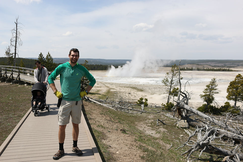
Eventually I would roll into the resort area surrounding Old Faithfull. Lodges, a hotel, gifshops, restaurants, and a visitor center make up the resort. I had about an hour of roaming around before the next eruption. There is an entire viewing area surrounding the geyser and as the time for eruption neared it filled with onlookers holding up their cellphones and other picture taking devices. I’ve never seen so many tourists with their cameras in my life. The eruption came quickly, superheated sulfuric water bursting to the surface over 100 feet in the air quickly turning to steam. It was awe inspiring. Worth the trip even if I had to ride back.

Gawkers at Old Faithful.

It's alive!

After the eruption I went to eat some dinner at the grill next to the gift shop. I grabbed a bench and began making PB&Js when I heard the girl next sitting in the bench next to me talking about how she used to work at the park. I decided to run my plan passed her. I introduced myself and she told me her name was Sara. I told her I was planning on waiting until it was dark and then sneaking passed the barricade then book it during the night until I crossed the South Entrance, some 40 miles away. Although she was skeptical at first, the more she thought about it the more she considered it a good plan. But she advised me to not wait until dark because stumbling upon and surprising a grizzly or bison in the middle of the night was a very bad idea. I took her advice and at 5:00 pedalled passed the barricade. There was no ranger standing guard like I expected. Just a couple tourists who stared at me open mouthed as I blatantly disregarded the parks rules.
I had 40 miles to go, a steep hill to climb, and about 4 more hours of sunlight. It was totally doable. But I quickly came to find out why the road was closed. They were rebuilding a bridge. It was about 100 feet long and a skeleton concrete and rebar surrounded by tractors and heavy equipment. I looked around and didn’t see anyone, not only was it after 5:00 but it was also the weekend. Nimbly I carried my bike across the unfinished bridge. Passing this obstacle there was nothing else in my way. Although there was snow several feet high on the side of the road the pavement was clear. I made it to the South Entrance right at 9:00 with light to spare. My only scare had been a herd of elk that crossed the road right in front of me as I rounded a corner.

Just for automobiles... right?

Shhhh... don't tell anyone. Just crossed incomplete bridge by walking on rebar.
As I crossed the South Entrance into Teton Park, I saw a few cabins with their lights on. Forest ranger residences surely. I rode another half-mile or so to the first picnic area I saw and started setting up my tent. Right as I put the last pole into place I heard an audible SNAP and my tent collapsed. One of the polles had split right at the joint. This had to be instant karma for passing through the closed roads. I tried to fix the tent but to no avail. I decided to swallow my pride and see if the rangers would let me throw my sleeping pad on their floor. If not, plan B would be covering a picnic table with my rain fly and doing my best to stake it down. As I rode up to one of the cabins, still lit with electric lighting despite the late hour, I was greeted to the barks of a pair of dogs. Out ran a woman clearly frantic. When she saw me she let out a sigh of relief, thinking I had been a grizzly bear. I explained to her my plight and she went back inside to find her husband. He came out all business. Straight-backed and tight-laced, he was the head hauncho park ranger in the area. He told me I could not stay in any government owned buildings, not even in their shed. I was flummoxed. I couldn’t believe it. I think he knew I had snuck over the entrance and this was payback. Maybe not. He told me to go with my Plan B. He wasn’t exactly rude about it, but definitely wasn’t being helpful. After returning to the picnic area and beginning to set up my crude tent over the table I heard the rumble of a truck engine behind me and saw a pair of headlights. The park ranger had returned with a tent for me. He apologized for his rudeness, telling me he hadn’t really seen any visitors since before the park entrance had closed, back in November, especially not after 10:00 at night, and that I had frazzled him. I accepted his apology and made one of my own. I shook his hand and took the tent, set it up, and promptly went to bed. But not before hanging my bear bag.

Waterfall.

Frozen Lake.
Day 29: South Gate, WY to Jackson, WY 56.6 miles
Sunday, May 3rd
After waking up and returning the ranger’s tent to him I continued south to the Tetons. Here was yet another beautiful range of mountains. It was about 20 miles before I came upon signs of civilization when I arrived at a gas station/convenience store. While there, I talked with a pair of road cyclists who were very interested to hear about the gear I carried. I stocked up on water and took an impromptu shower in their sink, then ate some Mountain House freeze dried food a passerby gave me. My destination for that day was Jackson, WY and the road there would take me all the way through the national park, a very scenic ride I was told, and indeed it was. Although there wasn’t near as much wildlife as I had seen in Yellowstone, the Teton mountain range in the backdrop was gorgeous. Despite being rained on for part of the day, I was all smiles.

My new tent, copmliments of Teton Park Rangers.

Entrance to Teton Park.


Teton mountain range.

Interesting heron.
As I neared Jackson I passed by a visitor center where I learned all bout the area’s flora and fauna and history. The Teton’s were a very popular mountaineer’s destination and as its popularity grew so too did the need for a mountain rescue team. The nation’s first rescue team was developed here and is still one of the most active search and rescue organizations. The visitor center had a plethora of info and I learned about the fault line at the base of the mountain range and how it continues to shape the area. I learned about the sagebrush at the base of the range and how the ecosystems surrounding it. Really quite interesting stuff, I don’t think I can do it the justice it deserves; you just have to visit there yourself.
After leaving the visitor center I hopped on a road bike trail that wound its way all the way to Jackson, where I would eat dinner at a snazzy local brewery and stay the night with my WarmShowers host Lauren. Her rambler was quaint and full of books about travel. Her garage was stacked with bicycles and on the wall was hung guitars and interesting art pieces. She had a spare bedroom for me and shower that I’m sure I desperately needed, although by this point I had lost the ability to smell myself. Before crashing, Lauren told me about her adventures bike tourning around South America, something I had always wanted to do. After saying goodnight to her I layed down in bed and used her wifi to watch a couple episodes of Game of Thrones, one of my guilty pleasures. I slept great that night. The next day would be blogging and planning the next leg of my trip.

Bike trail through the park into Jackson.

Some nice brew and steak tacos.
Comments